Python geospatial analysis of Tempe green space and urban tree biodiversity
A Python-based GIS final project analyzing the distribution of green spaces and urban tree biodiversity in Tempe, Arizona for GIS 322 (Programming Principles GIS II). The work pulls park, garden, and playground polygons from OpenStreetMap via OSMnx and combines them with the City of Tempe tree inventory to map green space coverage, tree species diversity, and the environmental benefits trees provide. The repository also includes the six module assignment notebooks completed over the course alongside the final deliverable.
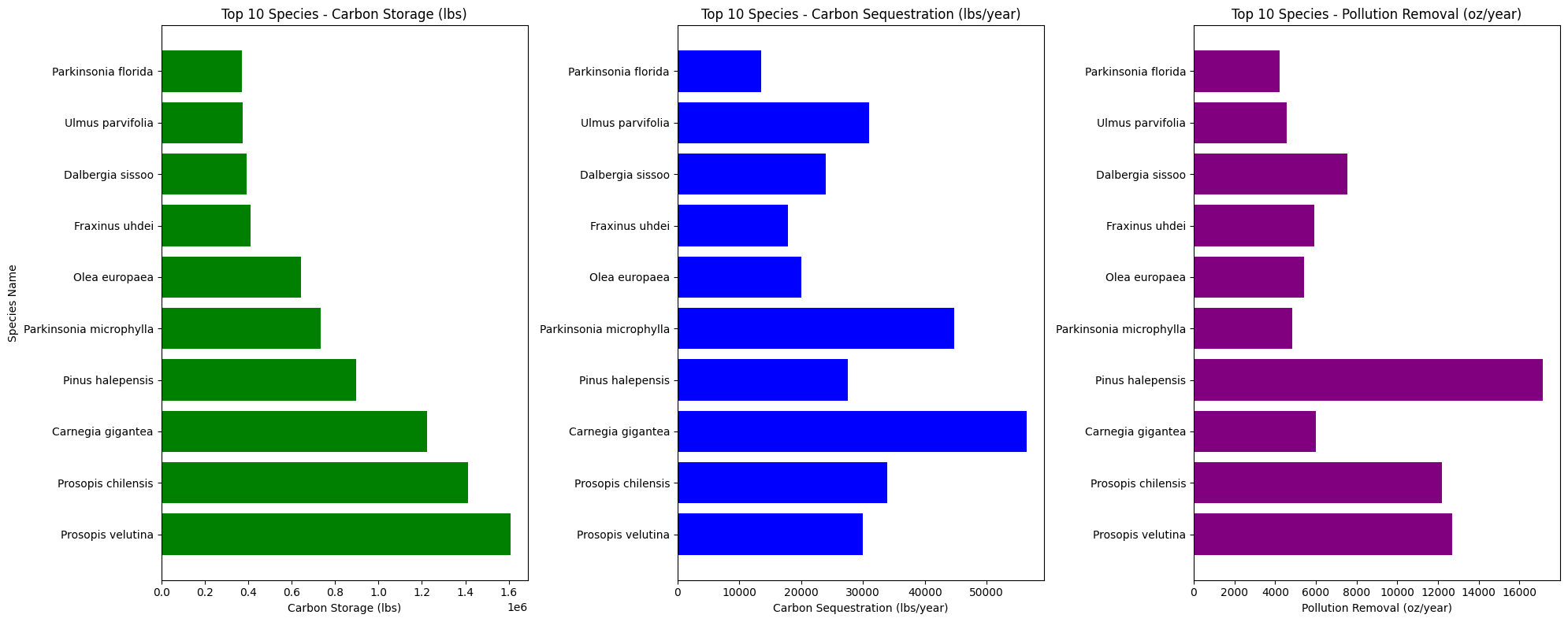
Following a multi-stage workflow of data collection, preprocessing, spatial analysis, and visualization, OSM green space features were queried by leisure tags and the tree inventory was cleaned to retain species and geometry fields. Both layers were reprojected to UTM Zone 12N so green space area and spatial relationships could be measured consistently. Tree species were summarized by frequency, and environmental benefit attributes such as carbon storage were mapped spatially to show where Tempe's urban forest contributes most.
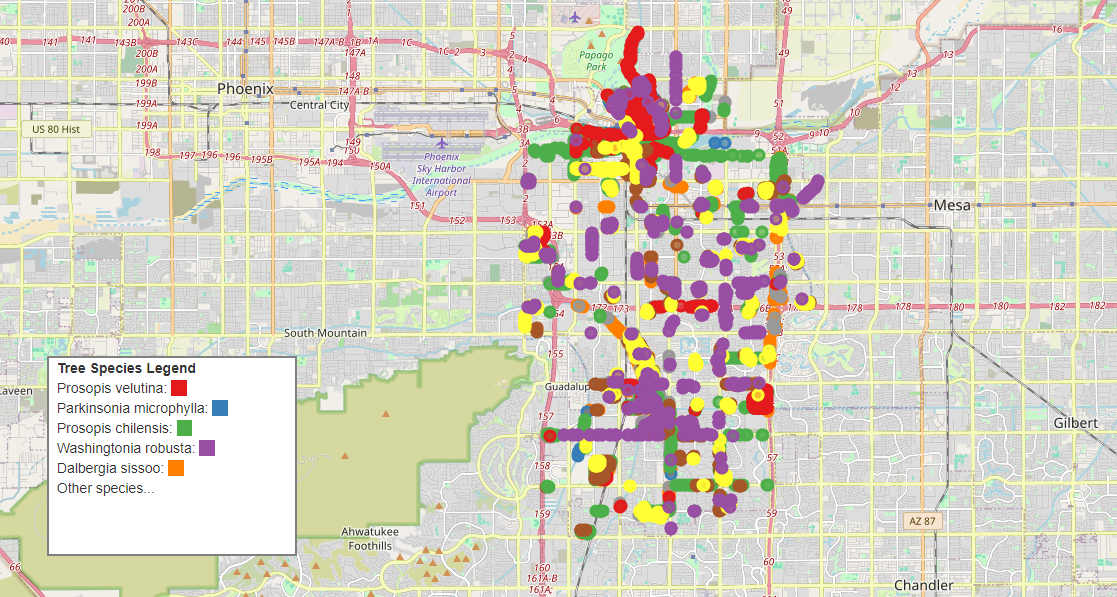
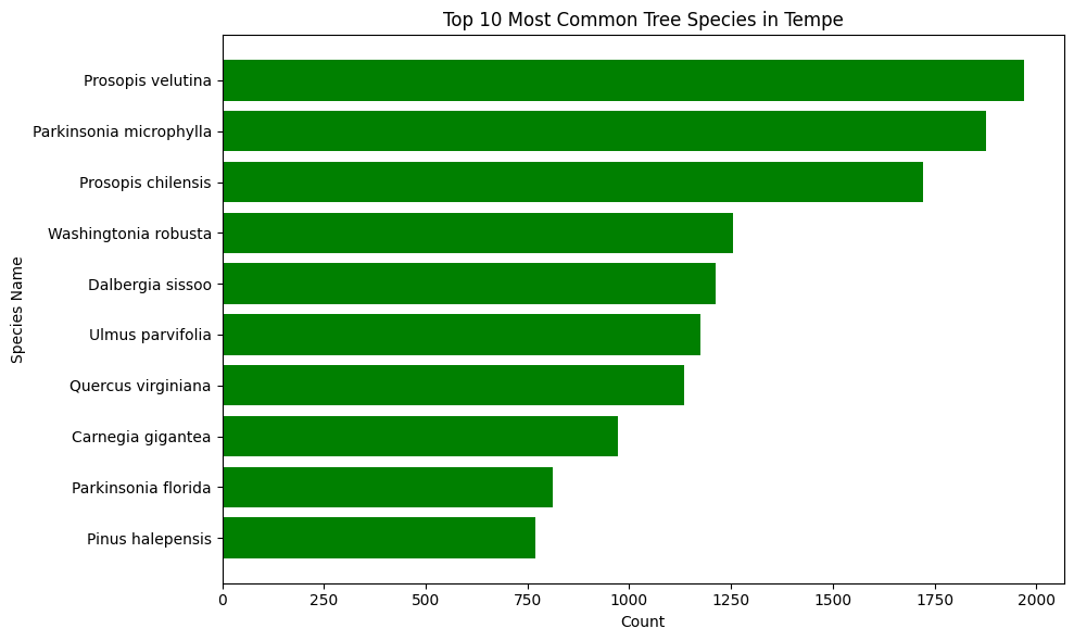
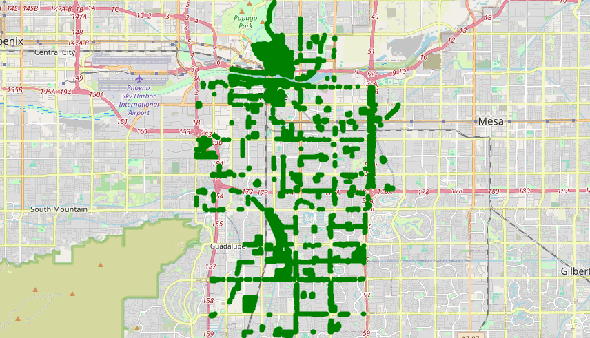
The analysis produced a set of maps and charts characterizing Tempe's green space coverage and urban tree biodiversity, surfacing uneven tree distribution and the dominance of drought-resistant species; full findings, figures, and limitations are documented in docs/GIS322_Final_Project_Elsaady.pdf.